China Is Building A Great Wall Of Undersea Sensors To Track U.S Nuclear Submarines In Indo-Pacific


China is building a network of undersea sensors in the Pacific Ocean to detect the U.S. Navy’s nuclear submarines and secure its sea-based nuclear deterrent.
Experts say there might come a time when Western submarines will not be able to tap into their stealth advantage while operating in the Indo-Pacific, especially the South China Sea, which Beijing claims to be a part of its territory.
China’s New Undersea Strategy
Testifying before the U.S.-China Economic and Security Review Commission, Rear Admiral Mike Brookes warned that Beijing views undersea warfare as a pillar of “systems confrontation.”
Beijing plans to integrate air, seabed, surface and space sensor systems to create a unified infrastructural network to exert its control over key maritime regions and force enemy submarines, especially the U.S naval subs, to withdraw.
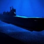
The People’s Liberation Army Navy (PLAN) currently has over 60 submarines, including Shang III nuclear-guided missile submarines (SSGNs) equipped with 24-cell vertical launch systems (VLS), alongside Type 094 Jin-class nuclear ballistic missile submarines (SSBNs).
Armed with long-range JL-3 missiles, these SSBNs can target parts of the U.S. mainland directly from protected Chinese waters.
China is also expanding its shipbuilding capabilities and ramping up production to maintain its growth trajectory into the 2030s.
Underwater Great Wall Of Sensors
China is also developing the next-generation Type 095 attack submarines (SSNs), Type 096 SSBNs, and unmanned underwater vehicles (UUVs).
Vice Admiral Richard Seif said that this modernisation, coupled with expanded anti-submarine warfare forces, forms a literal “Underwater Great Wall.”
If China can detect enemy submarines in vital maritime chokepoints, it increases operational risks for the U.S. and its allies and could complicate future missions during a conflict or regional crisis.
5 Layers of Ocean Surveillance
According to defence analysts Tye Graham and Peter Singer, China’s undersea sensor network, the “Blue Ocean Information Network”, comprises 5 interconnected layers spanning from the seabed to space:
- The Ocean Star Cluster: A satellite constellation utilising the Guanlan radar altimetry and light detection and ranging (LIDAR) system to map the ocean via pulsed lasers.
- The Air-Sea Interface: A network of smart buoys, wave gliders, and unmanned surface vessels acting as data relays.
- The Starry Deep Sea: A fleet of subsurface floats, gliders, and autonomous underwater vehicles.
- The Undersea Perspective: A matrix of fixed seabed observatories and cabled hubs.
- The Deep Blue Brain: An artificial intelligence and data management core that integrates information across all domains.
According to the Asia Maritime Transparency Initiative (AMTI), this network is heavily concentrated in the northern South China Sea, stretching between Hainan Island and the Paracel Islands.
Floating and fixed “Ocean E-Stations” monitor critical chokepoints like the Qiongzhou Strait.
Beijing is planning to expand this network into the East China Sea, polar waters, and along the Maritime Silk Road.
Protecting the Nuclear Arsenal
This vast network aims to protect Beijing’s nuclear arsenal within a strategic bastion in the South China Sea.
Professor Chi Guocang of the PLAN Submarine Academy noted that China has achieved “continuous strategic duty,” meaning at least one Type 094 SSBN remains on 24-hour, year-round patrol, ever ready to launch a nuclear counterattack.
Chi stated that a fleet of 6 Type 094 SSBNs provides the necessary redundancy to handle global emergencies.
This bastion strategy directly responds to American surveillance.
Reports from the China Maritime Studies Institute reveal Chinese anxieties that U.S. attack submarines can continuously track every Chinese SSBN during peacetime patrols.
Highlighting this friction, the South China Sea Probing Initiative recorded that 11 U.S. SSNs, two SSGNs, and a U.S. SSBN operated in the Western Pacific in 2024 alone, supported by specialised submarine tenders.
China’s First Island Chain
China is refining its Shang-class SSNs. Variants like the Type 093B have advanced pneumatic isolation mounts, towed-array sonars, and drag-reducing sails to maximise stealth.
These faster and quieter attack submarines can escort Chinese aircraft carriers, threaten U.S. logistics fleets, or even attack Pacific bases.
However, China is still geographically constrained by the First Island Chain, which spans Japan, Taiwan, and the Philippines.
To reach the open Pacific, Chinese submarines must pass through chokepoints like the Miyako Strait and Bashi Channel, which are heavily monitored.
Want to read more?
Check out the full article on the original site