Captain-less Ships To Conduct High-Resolution Ocean Floor Mapping Under New U.S Navy Project
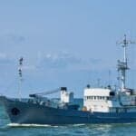


U.S Navy has selected Blue Water Autonomy, a technology and shipbuilding company based in Boston, to conduct ocean floor mapping with the help of uncrewed surface vessels.
The US Naval Oceanographic Office (NAVOCEANO) decided to give the company a multi-year, indefinite-delivery and indefinite-quantity contract with a value of $40 million.
According to sources, the company, however, would compete for specific task orders with other contractors chosen for the project, which supports ocean survey missions.
These deep-sea surveys need vessels which can sail to thousands of nautical miles for long periods to collect information in the form of accurate and high-resolution seafloor maps, images, videos, and environmental data, including the type of terrain, and record changing ocean conditions which could influence future naval operations and so on.
These surveys, traditionally, have been carried out by crewed survey ships; however, they can cost thousands of dollars a day.
NAVOCEANO is planning to use uncrewed systems for these missions to increase precision, record more data and lower the costs, along with reducing risks for personnel.
This approach would allow the U.S to cover more ocean areas in less time as well.
“Mapping the open ocean is exactly the kind of long, high-endurance work that autonomous vessels are built for,” said Rylan Hamilton, CEO of Blue Water Autonomy.
“This selection puts our autonomy to work across the Indian and Pacific oceans, well beyond the range of a crewed survey ship, and it shows the technology we are building serves many different missions,” Hamilton added.
A company official noted that its autonomous surface vessels are designed to conduct such operations in remote maritime environments without the need for a dedicated team onboard.
Want to read more?
Check out the full article on the original site